Located:
- Lat: N39°30.50′
Long: W107°18.69′ - Elevation: 5916 Ft MSL
- RWY: 14/32 3305×50 Feet
Asphalt – Excellent Condition- RWY 32 preferred for arrivals
RWY 14 for departures (winds permitting) - RWY 14 departure: stay left over Highway 82 until leaving 7,000 for noise abatement.
- RWY 32 preferred for arrivals
- Lights: None
- Radio: CTAF/SUPER UNICOM 123.0
(click mike 3 times for weather / 4 times for radio check)
Airport Services:
- 100LL – (24 Hour Self Service, Credit Card) – $5.94/gal
- Jet A – (24 Hour Self Service, Credit Card) – $5.94/gal
- Courtesy Car
- FBO with free Wi-Fi and Shower
- NO Landing Fees
- Tie-Down Fees: $10/night
- Monthly Tie-Down: $75/month
- Commercial Tie-Down Fees: $50/night plus $50/night for each support vehicle
- Aircraft Maintenance Shop – Aircraft Repair, LLC 970-928-7912
Noise and Landing Procedures:
- Pattern altitudes of 1,000 are recommended. The AIM (4-3-4) suggests that high-performance aircraft should fly patterns 500′ higher than low performance 7,000 MSL
- Prefer RWY 32 for arrivals and RWY 14 for departures
(winds permitting) - No touch and goes
- Night landings prohibited
General Information:
- Winds usually increase in the afternoon!
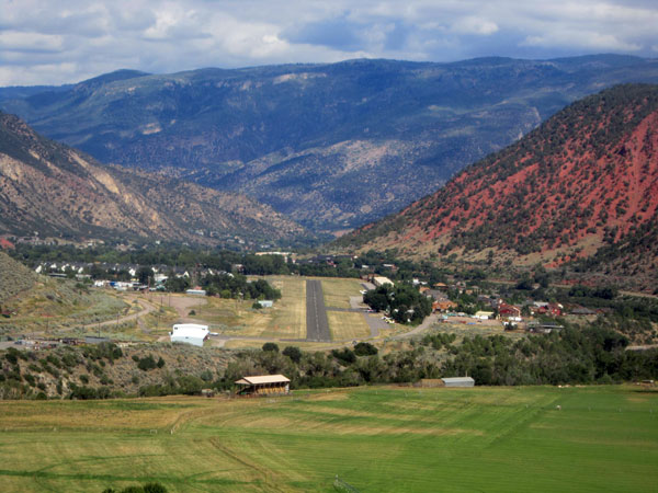
- RWY 32 slopes up to north giving a mild optical illusion. If unfamiliar with the airport, local pilots suggest 6500 MSL at the poplar trees until near the river.
- Numerous 25-50′ buildings, equipment and tie-downs approx. 200′ from center-line of RWY – both sides
- Mountainous terrain surrounding airport
- RCO 122.2 (DEN FSS)
- Nearby RIL AWOS 970-625-2206 and EGE AWOS 970-524-7386 are helpful for sky conditions, altimeter, winds
- Click mic 3x on 123.0 for automated weather updates
- Click mic 4x for radio check

